By: Andrew Edwards
Tuesday Tip: Hiking Wiser
Have you or someone you know ever considered taking some time off to hike a long-distance trail here in the U.S. or in a foreign country? If that person is you, then now is a very exciting time and I encourage you to continue following that dream until you make it a reality. If that person is someone you know, encourage them to do the same. If you are neither, continue to read this anyways to open yourself up to the world of long-distance hiking as I share with you one of the most popular hiking technologies being used each and every day out on trails across the world.
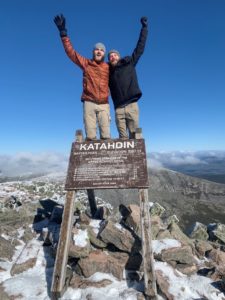
From May 8, 2019 – October 5, 2019 I, Andrew Edwards (trail name: Cyborg), hiked all 2,192 miles of the Appalachian Trail from Springer Mountain, GA to Mount Katahdin, ME. This was my first long-distance hike, and frankly my first backpacking trip. With little to no experience, almost all of my preparation for the hike relied on YouTube videos, subreddits, and talking to people in my community that had gone on backpacking trips in the past. Through this process, I was eventually introduced to the mobile-app that the majority of long-distance hikers utilize nowadays: Guthook by Atlas Guides.
Last April before I embarked on my 14-state trek on the Appalachian Trail, I wrote a Tuesday Tip featuring Guthook titled Hiking Smarter, which outlined the app’s general functions and uses. It’s a quick read, and I encourage you to check it out. Because I published this article prior to my hike, I hadn’t been able to truly put the app’s features to the test out in the woods. Well, now that I’ve walked from Georgia to Maine using Guthook for all 151 days of my hike, I’d like to take the time to tell you about the ways in which the app both served me well and not so well on the trail, and how you can use this app as a pivotal resource for your own long-distance hike.
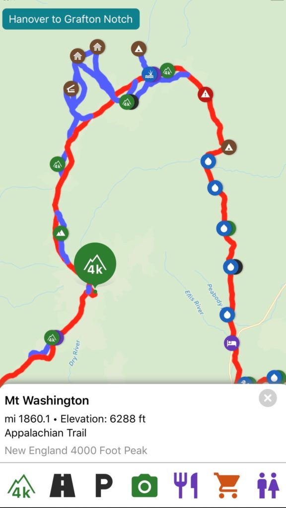
Guthook is a comprehensive guide to long-distance trails. Everything you need to know about the trail you are on (whether it be the Appalachian Trail in the U.S. or the Te Araroa in New Zealand) is already mapped out for you. This includes water sources, food resupply points (towns), tent sites and shelters, elevation profiles, and more, including pictures of these waypoints and comments from recent hikers in the area providing reasonably up-to-date information.
Let’s start with how Guthook served me well on the trail. First, having access to a map of all water sources that span the 2,192-mile A.T. right on my phone proved to be a huge advantage. I intake a lot of water throughout the day (more than your average thru-hiker), so being able to see on a map the water sources (streams, springs, rivers, ponds ect.) that lie ahead (many water sources are not on-trail, forcing you to side-track and hike to them) was pertinent in order to properly allocate the amount of water I needed to carry during various times of the day. After a long day of hiking, I’d prefer to bring in 2-3 liters of water into camp each night for hydration, cooking, and hygiene, and Guthook allowed me to make sure I was going to be able to secure those 2-3 liters night in and night out.
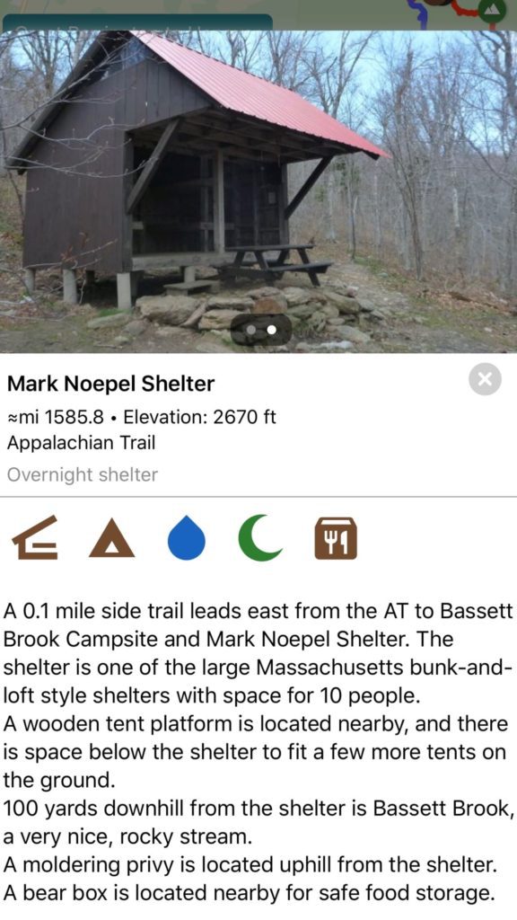
Another feature of the app which proved to be very useful was the mapping of shelters and tent sites along the trail. There are
about 260 shelters along the Appalachian Trail – all in different sizes and styles – but typically are able to sleep between 6-12 hikers and include a basic design of 3 wooden or stone walls and a tin roof. While I rarely actually slept in the shelter for a variety of reasons (mice, bugs, snoring hikers), I typically camped out somewhere around the shelter with my tent wherever there was a cleared-out, flat area of dirt or grass. With the help of Guthook, I was able to look ahead and read descriptions of these shelters within the app, and find out roughly how many tent sites were available in the surrounding area to help me decide just where I was going to sleep that night. Because if you tent out on a sloped surface, chances are you are not going to get a good night’s rest, and this app helped to avoid that situation in a quest to settle for only the finest of tent sites (wasn’t always the case).
Yet another large advantage you will be able to leverage on the trail with Guthook is the way in which the app maps resupply
points, which is typically going to end up being a town. Since you can only carry so many days worth of food with you at a time out in the woods, you are going to have to stop off in towns every so often to get more food. You might also be interested in treating yourself to a shower, a bed for the night and hey, maybe even a beer. The app provides all the necessary information you need to know about these towns that aren’t too far off from the trail. Everything from phone numbers to call for shuttle service, restaurants in the area, motels with special thru-hiker rates, hostels, post office, grocery stores, laundromat, and more are marked on the map so that you can get somewhat of an itinerary together for your trip into town.
After spending a much-needed night in town to recover from the many miles you’ve hiked and all the pop-tarts and instant pasta’s you’ve consumed days prior, Guthook serves as a great way to plan out the week of hiking ahead until you need to get off-trail for another resupply (this depends on your hiking pace and itinerary but I typically carried 3-6 days worth of food at a time, hiking 40-100 miles in that span). With the help of the app and its elevation profile feature which allowed me to see how steep each climb was going to be, I was able to roughly calculate how many miles I was going to be able to hike each day until making it to the resupply point of my choice. There’s no shortage of towns near the A.T., in fact, the trail actually travels right through a half-dozen towns or so which is really nice, with the majority of towns being another 5-10 miles off of the trail, requiring you to hitch, hike, or shuttle in to them.
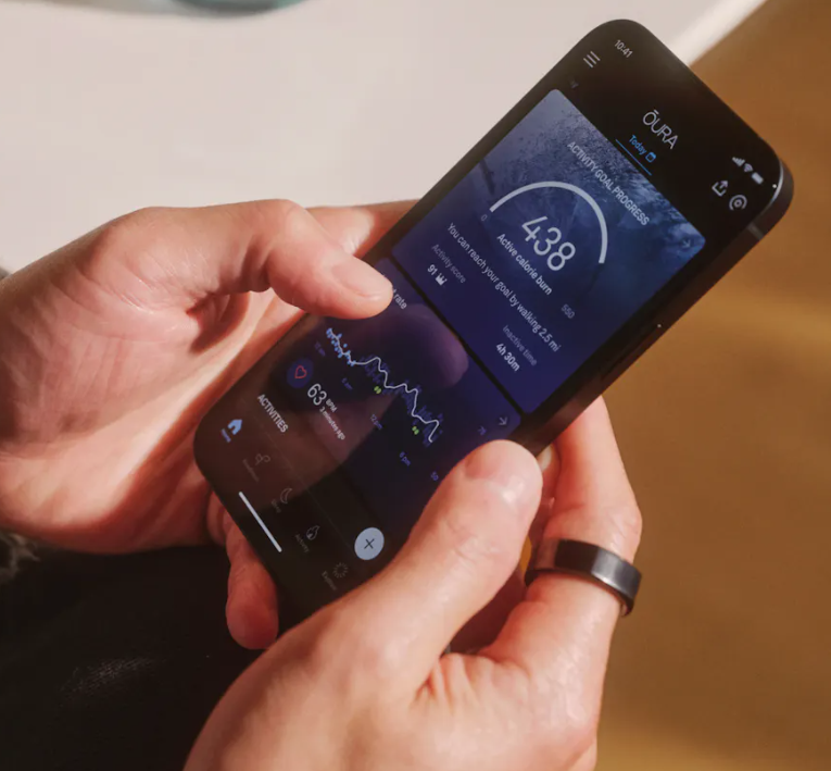
A final advantage of Guthook I would like to touch on is the mental advantage you get by being able to visualize all of your progress on whichever trail you embark on.
Long-distance hiking can get tough physically, mentally and emotionally. Opening the app and looking back on how far you’ve come by scrolling through the places you’ve seen and the state lines you’ve crossed can act as a morale boost as you lay in your tent at night after a hard-earned 20-mile day; at least it was for me anyways.
So, what could be wrong with this seemingly flawless state-of-the-arc 21st-century trail guide? Not a whole lot, really. Instead it’s how, or rather how much you use the app where it can start to potentially have a negative impact on your hike. Just like with most devices, apps, and social media platforms out there, Guthook is really at its best when it’s used in moderation. Constantly checking your phone every 20 minutes to see how far you’ve walked or how steep the grade is that you’re about to climb can become truly mentally exhausting. If and when you download Guthook for you or someone you know, I do implore you to utilize the app for the many logistical components of your hike as previously mentioned above, but also please take it from me to have a sort of discipline about yourself to put the phone away when it’s not necessary to use and truly enjoy wherever the trail takes you each and every day. After all, a wise man out on the trail once told me it’s about the smiles, not the miles.
Having the privilege to hike the Appalachian Trail in the summer of 2019 turned out to be the most unique, difficult, and best experience of my life all in one. By utilizing the technology of Guthook by Atlas Guides, I was able to more efficiently move my body through places like Great Smoky Mountain National Park in Tennessee and North Carolina, Shenandoah National Park in Virginia, and the stunning White Mountain National Forest of New Hampshire. Could I have traversed these lands without this app in my pocket? Sure. But when given the choice, it’s something that I wouldn’t want to hike a long-distance trail without.
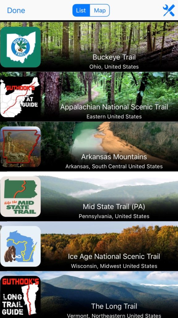
Whether you or someone you know is considering a long-distance trail such as the PCT (Pacific Crest Trail), Long Trail (Vermont), CT (Colorado
Trail), AZT (Arizona Trail), Appalachian Trail, or beyond, add Guthook by Atlas Guides to the long list of gear to purchase for your trek. It proved capable of guiding me from start to finish on my own hike, and I’m sure it’ll do the same for you.
Happy Trails!

A recent graduate of the University of Georgia, Andrew joins the Network 1 team in 2019 as a key member of the Sales and Marketing Team. Andrew earned a Certificate in New Media during his time at UGA where he was able to hone in on his creative abilities, which he now deploys within Network 1’s marketing efforts.
aedwards@network1consulting.com or 770.655.4061
Network 1 Consulting is a 21-year-old, IT Support company in Atlanta, GA. We become – or augment – the IT department for law firms and medical practices. Our IT experts can fix computers – but what our clients value most are the industry-specific best practices we bring to their firms. This is especially important with technology, along with regulations and cyber threats, changing so rapidly. We take a proactive approach to helping our clients use technology to gain and keep their competitive advantage.